Duranus - L'Eguisse mine - walk - hike
This walk proved to be full of surprises, the area is made up of ‘schist' rock and limestone formation. This can erode easily to give steep and dramatic slopes. This erosion can not only effect the navigation of the paths but can change their course - so maps are not always up to date. The path in its current state is about 8.5 km long and the height climbed is 1040 m and a Grade 2.
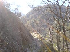
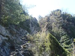
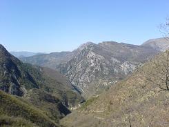
The quickest way to Duranus from the coast is via the RN202 then turn up the D2565 to St Martin Vésube. The problem with Duranus is the lack of parking, there is a space near the start of the walk and there are some others along the road but that is about it. The walk starts from the left hand side of the road past the houses in the village and before the bridge. The walk starts at sign post 461 and climbs quickly up the valley side through oak scrub. The path does fork take the sign posted one on the left continuing up. The walk is a local walk and has the typical yellow flashes to show the route. The path now follows the valley side and crosses a number of edges with a steep climb before each one.
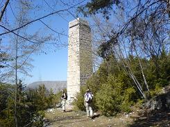
This time of year - spring (April) the north facing slopes protect are very green with forest flowers. There is also a small cascade before the final ascent to the site of the mine. There are meant to be left over machinery from the mine workings but access is now forbidden for safety purposes. The path continues up from the mine chimney and opens out at sign post 459, from there take a S- SE direction to continue around the valley side. The electricity pylon follows our path for a 100m or so until you cross a stream and head WSW.
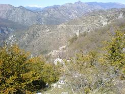
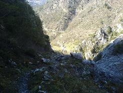
The path is well marked with the yellow flashes and contours the mountainside in an open meadow. There is an occasional climb now as you skirt the valley side and a couple of zig zag descents. Eventually you come to sign post 458 and from here on in you descend in earnest to the village. The path becomes broader and more well defined after you have crossed the stream with one small rock field to descend. This takes you to sign post 462 which is on the opposite side of the bridge on the road from where the walk started.
Actual distance 8672.43 m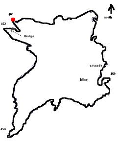
Total height climbed 1043 m
Maximum height 972 m
Trail : Waypoints
SP 461 East: 32:360740.30 North: 32:4861272.63 Height: 431 m
SP mine East: 32:361825.07 North: 32:4860283.34 Height: 893 m
SP 458 East: 32:360496.32 North: 32:4859649.23 Height: 789 m
SP 462 East: 32:360578.93 North: 32:4861169.39 Height: 412 m
