Les Gorges de la Cagnes walk
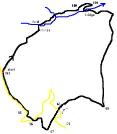
We were looking to squeeze a walk in before the New Year but the weather was not looking good, we got soaked on the Baou last Sunday, so it was with some trepidation and packed water proofs we set off for the Col de Vence. This walk takes you down the Gorges de la Cagne to where they used to mine coal of all things, you cross the river and proceed along the valley floor, climb to the GR51, re-cross the river to the Plan des Noves and back to Col de Vence. To get there drive through Vence and take the road to Col de Vence the D2, pass the car park for the Plan des Noves and continue on to the Col. You pass 3 horse riding stables, the last is Fort Apache on the left then there is a generous parking 300 m on the right just before the road veers to the left. This is also the start of the walk and it is marked with yellow markers and descends through the trees.
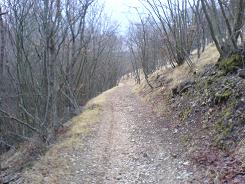
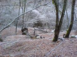
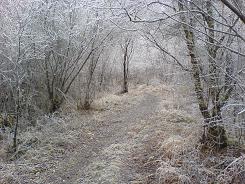
There was a hoar frost in the Gorges which was a blessing as it would be very wet underfoot otherwise. There is a ford that has some steeping stones and the path follows the river before opening out under the trees. We found some evidence the hunting season is still in full swing there was fresh blood on the path, I just hope they never think wild boar walk upright with orange ruck sacs.
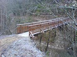
The path climbs up and broadens to a dirt track - keep going until you get to sign post 140, the peanut brained vandals have been there before you, but just look out for a smaller path on the right going down - take it. A couple of hundred yards further on you get to sign post 139, you take a right there down into the valley and you are on the GR51. This takes you to a bridge, which in the summer is a great place to dip your toes in the river and take a rest stop.
From the bridge the path winds up the side of the valley and takes you up to the Plan des Noves. There is a lot of evidence of settlers on these plains with terracing and walls but all there is today are lovely oak groves and the ghosts of those that lived there.
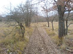
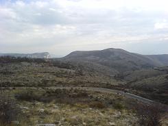
The walk is very straight forward from here on in, keep to the GR51, it does take a sharp right at sign post 65 and takes you up to the car park on the D2. This you need to cross and the road, the path continues on the other side of the road climbing gradually, the views looking back are of the Baou de St Jannet and the Plan des Noves. At sign post 67 you come off the GR51 turning right up the hill, when you get close to the road the path forks take the left one and you will come to a walk sign post - cross the road at that point. The path then takes you to another road crossing and continues on the other side for about 100m to sign post 55 and there it ends. So from now on you have to put your life in the hands of the local motorists, so make sure your life insurance premiums are up to date and you follow the main road for just over a km.
Flat distance 11392.69 m
Total height ascended 577 m
Actual distance 11507.30 m
Total height descended 577 m
Minimum height 632 m
Maximum height 968 m
Trail : Waypoints
143 East: 32:344640.52 North: 32:4847969.86 Height: 926 m
140 East: 32:346905.65 North: 32:4849609.74 Height: 728 m
139 East: 32:347142.07 North: 32:4849583.31 Height: 709 m
129 East: 32:346909.41 North: 32:4849417.19 Height: 636 m
65 East: 32:347199.68 North: 32:4846867.35 Height: 674 m
66 East: 32:345980.24 North: 32:4846870.03 Height: 792 m
55 East: 32:345155.71 North: 32:4846760.08 Height: 934 m
143 East: 32:344640.52 North: 32:4847969.86 Height: 926 m
Co-ordinates system : UTM (Zones 30,31,32), WGS84
